
Ol Doinyo Lengai is one of the most unusual volcanic mountains in Tanzania. If you’re looking to explore Ol Doinyo Lengai, you’ll discover that rising to 2,962 metres above sea level, this active stratovolcano stands near Lake Natron in the Gregory Rift Valley of northern Tanzania.
Moreover, the mountain is important to the Maasai people, who call it “Ol Doinyo Lengai,” meaning “Mountain of God.” Its volcanic landscape, cultural importance, and views across the Rift Valley make the area a fascinating destination for adventurous travelers.
For travelers who enjoy hiking, geology, culture, and dramatic landscapes, Ol Doinyo Lengai offers a different experience from Tanzania’s famous safari parks. Therefore, exploring this mountain can be combined with Lake Natron, Engaresero, and other attractions along the Ol Doinyo Lengai Route.
What Is Ol Doinyo Lengai?
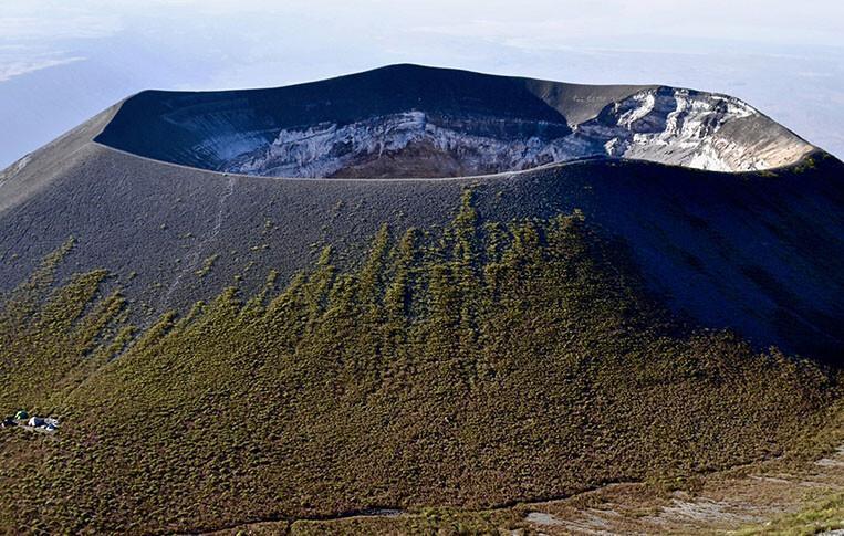
Ol Doinyo Lengai is an active stratovolcano in northern Tanzania. It reaches 2,962 metres (9,718 feet) above sea level and rises dramatically from the surrounding Rift Valley landscape.
The mountain is located south of Lake Natron, within the Gregory Rift Valley. It forms part of the wider East African Rift System, an important geological region known for volcanoes, escarpments, lakes, and other dramatic landforms.
Unlike many mountain destinations, Ol Doinyo Lengai combines adventure with geology and culture. As a result, visitors can experience a challenging hike while also learning about volcanic activity and the Maasai communities of the surrounding area.
Why Is Ol Doinyo Lengai Called the Mountain of God?
The name Ol Doinyo Lengai means “Mountain of God” in the Maasai language. The mountain is regarded as sacred by Maasai communities living in the surrounding region.
Traditionally, the mountain has had an important spiritual role in Maasai culture. Therefore, visiting Ol Doinyo Lengai is not only a geological or hiking experience but also an opportunity to understand the cultural meaning attached to the landscape.
However, visitors should approach the mountain and surrounding communities respectfully. Cultural sites, local traditions, and religious beliefs should be treated with care throughout the journey.
Where Is Ol Doinyo Lengai Located?
Ol Doinyo Lengai is located in northern Tanzania, near Lake Natron and within the Gregory Rift Valley. The mountain stands in the wider Ngorongoro-Lengai landscape and is connected by road routes through Mto wa Mbu, Karatu, and Engaruka.
From Arusha, travelers normally travel toward Mto wa Mbu before continuing through the Rift Valley landscape toward Engaruka and Lake Natron. The final part of the journey passes through remote areas and can involve rough roads, so a suitable safari vehicle is important.
Along the way, travelers can see Rift Valley escarpments, volcanic features, Maasai communities, Engaruka Ruins, and other attractions. Consequently, the journey itself can become part of the Ol Doinyo Lengai experience.
How Do You Get to Ol Doinyo Lengai From Arusha?
The most common road journey from Arusha follows the northern Tanzania route toward Mto wa Mbu and then continues toward Engaruka and Lake Natron. From there, travelers continue to the area around Engaresero, close to the mountain and Lake Natron.
The road distance and travel time can vary according to the route, road conditions, weather, and the exact starting point. Current tourism information places Lake Natron roughly 215 km from Arusha, with the journey taking up to about five hours under suitable road conditions.
Therefore, travelers should allow extra time rather than planning the journey around an exact driving duration. A 4×4 safari vehicle is particularly useful because some sections toward Lake Natron are rough and remote.
What Makes Ol Doinyo Lengai Different From Other Volcanoes?
One of the most remarkable facts about Ol Doinyo Lengai is its unusual lava. The volcano is known for producing carbonatite lava, which is chemically very different from the silica-rich lava produced by most other volcanoes.
Carbonatite lava is rich in carbonate minerals, including sodium and calcium compounds. Consequently, its chemical composition and appearance are very different from the bright red or orange lava that people often imagine when they think about a volcano.
This unusual geology makes Ol Doinyo Lengai particularly important to scientists and geology enthusiasts. In fact, the Smithsonian Global Volcanism Program identifies it as the only volcano known to have erupted carbonatite lava in historical time.
Why Does Ol Doinyo Lengai Have Black Lava?
Ol Doinyo Lengai’s carbonatite lava can erupt at a much lower temperature than typical basaltic lava. The Ngorongoro Lengai Geopark gives a temperature of approximately 510°C (950°F) for this unusual lava.
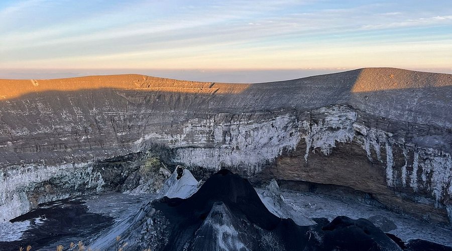
Because of its unusual composition and relatively low temperature, fresh carbonatite lava can appear dark or black in sunlight rather than glowing bright red. Therefore, photographs of the mountain may show volcanic material that looks very different from the classic image of flowing lava.
Interestingly, the volcanic material can change colour after reaching the surface. The Geopark explains that the carbonate minerals are unstable at Earth’s surface and can weather from black to grey and eventually lighter colours.
Is Ol Doinyo Lengai Still an Active Volcano?
Yes. Ol Doinyo Lengai is an active volcano, and the Smithsonian Global Volcanism Program currently lists its last known eruption as 2026 CE. Its geological record includes repeated periods of volcanic activity.
Historical activity has included major eruptive periods such as 2007–2008, while the Ngorongoro Lengai Geopark lists 2013 among the mountain’s major eruption periods. These different records reflect the complex history of activity at the volcano.
Because volcanic conditions can change, travelers should always check current local information before climbing. A guide can also assess conditions and cancel or change the climb when conditions are unsuitable. Tanzania’s tourism information specifically notes that conditions on the mountain can change and that guides may cancel an ascent when necessary.
What Is It Like to Hike Ol Doinyo Lengai?
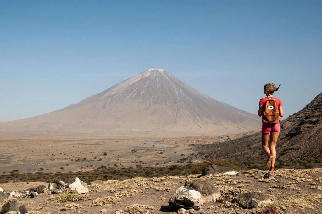
Hiking Ol Doinyo Lengai is a physically demanding experience. The route involves steep volcanic terrain, loose ash, and rocky surfaces, with a large elevation gain from the surrounding Rift Valley to the summit.
Unlike a gentle nature walk, the climb requires continuous effort and careful footing. Therefore, travelers should prepare their legs and cardiovascular fitness before attempting the mountain.
The traditional climbing schedule also makes the experience unusual. Many climbs begin around midnight so that hikers can tackle the steep ascent during the cooler hours and aim to reach the summit around sunrise.
Is It Easy to Hike Ol Doinyo Lengai?
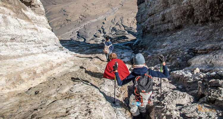
Ol Doinyo Lengai is not an easy hike. Although its summit is lower than Mount Kilimanjaro, the steep gradient, loose volcanic ash, rocky surface, heat, and significant elevation gain can make the climb physically demanding.
Furthermore, the descent requires careful movement because loose volcanic material can make the footing unstable. Hikers should therefore have good walking fitness and should not treat the mountain as a casual sightseeing walk.
The exact hiking duration varies between routes, guides, weather, and individual fitness. Published itineraries commonly describe a long overnight experience, with some estimating approximately 5–7 hours for the ascent and several more hours for the descent.
What Is the Best Time for Hiking Ol Doinyo Lengai?
The best period for hiking depends on weather, trail conditions, road access, and current volcanic conditions. Dry periods are commonly preferred because wet conditions can make volcanic ash and rough access roads more difficult to navigate.
However, the exact conditions can change from season to season. Therefore, travelers should check the latest local conditions with their tour operator and guide before setting out.
Regardless of the month, the timing of the climb matters. Many itineraries use a nighttime or very early start because the Rift Valley environment can become hot during the day.
How Safe Is It to Hike Ol Doinyo Lengai?
Hiking an active volcano requires careful planning because volcanic conditions can change. The mountain also has steep slopes, loose volcanic material, heat, and limited shade, making preparation particularly important.
For this reason, visitors should climb with an experienced local guide and follow current instructions about where and when to walk. If volcanic activity, weather, or trail conditions become unsuitable, the climb should be postponed or cancelled.
Most importantly, visitors should never approach active volcanic vents or restricted areas on their own. The goal is to enjoy the mountain while respecting the natural hazards associated with an active volcanic environment.
What Should You Pack for an Ol Doinyo Lengai Hike?
Good preparation can make the hiking experience more comfortable. Because the ascent often takes place at night and the descent continues into daylight, travelers need equipment for both cool and hot conditions.
Essential items include:
- Strong hiking boots
- Headlamp and spare batteries
- Sufficient drinking water
- Warm jacket or fleece
- Long hiking trousers
- Hat or cap
- Sunglasses
- Sunscreen
- Lightweight backpack
- High-energy snacks
- Trekking poles
- Personal medication
- Camera or phone
Additionally, choose footwear with good grip because loose volcanic ash and rock can make the trail difficult. Your guide or tour operator can provide the latest packing recommendations based on the current route.
What Other Activities Can You Do Around Ol Doinyo Lengai?
Ol Doinyo Lengai is not only about climbing. The surrounding area contains several attractions that can be added to a Lake Natron itinerary.
One option is Lake Natron, a shallow alkaline lake famous for its striking landscape and birdlife. Travelers can also enjoy walks around the lake and explore the surrounding Rift Valley scenery.
Another popular activity is the Engaresero Waterfall hike. The Ngorongoro Lengai Geopark describes a hike of about 45 minutes along the river to a waterfall area with springs and a natural pool.
Visitors can also explore Engaruka Ruins, volcanic features, Maasai cultural experiences, and the Engaresero Footprints, where more than 400 human footprints have been discovered in volcanic ash.
What Can You See From Ol Doinyo Lengai?
One of the major rewards of climbing Ol Doinyo Lengai is the wide landscape visible from the mountain. From suitable viewpoints, travelers can look across Lake Natron and the surrounding Rift Valley.
On clear days, views may extend toward the Ngorongoro Highlands and other major mountains of northern Tanzania. The exact visibility depends on weather and atmospheric conditions.
Therefore, the summit experience is not only about reaching the highest point. It is also an opportunity to see the relationship between volcanoes, lakes, escarpments, and the wider East African Rift landscape.
Sample Ol Doinyo Lengai Hiking Itinerary
Day 1: Arusha to Lake Natron
Begin your journey from Arusha and travel toward Mto wa Mbu before continuing through the Rift Valley toward Lake Natron. The journey passes through changing landscapes and remote areas of northern Tanzania.
After arriving near Lake Natron, check into your camp or lodge and rest. You can use the afternoon for a Lake Natron walk, a waterfall visit, or a cultural experience, depending on your itinerary.
In the evening, have an early meal and prepare your hiking equipment. Because the climb usually begins late at night or around midnight, getting enough rest before the ascent is important.
Day 2: Midnight Climb and Summit
Wake up around late evening or midnight, depending on your guide’s schedule. After a briefing and final equipment check, begin the steep ascent with a headlamp and local guide.
Continue climbing through the night while taking regular breaks for hydration and recovery. The goal is generally to reach the upper mountain around sunrise, although the exact timing depends on fitness, weather, trail conditions, and the group.
At the summit area, enjoy the views and volcanic landscape if conditions permit. Afterward, begin the descent carefully and return to the base area for food, rest, and recovery. Published tourism itineraries commonly combine the climb with a return to camp and, where time allows, a Lake Natron visit.
Day 3: Lake Natron to Arusha
After breakfast, you can spend the morning exploring Lake Natron or nearby attractions. Depending on your interests, this can include birdwatching, a cultural visit, or another short nature walk.
Later, begin the journey back toward Arusha. The route provides opportunities to appreciate the Rift Valley landscapes and, depending on the itinerary, stop at attractions around Engaruka.
By the end of the journey, you will have experienced a combination of volcanic scenery, Maasai culture, Lake Natron, and one of Tanzania’s most distinctive mountain adventures.
Why Combine Ol Doinyo Lengai With Lake Natron?
Ol Doinyo Lengai and Lake Natron work naturally together in a northern Tanzania itinerary. The mountain rises above the wider Lake Natron landscape, creating a dramatic combination of volcano, Rift Valley, and alkaline lake scenery.
Moreover, Lake Natron offers activities that can complement a demanding mountain climb. Visitors can explore the lake, observe birds, visit waterfalls, and learn about local Maasai culture.
As a result, travelers do not need to make the trip only about climbing. A combination of hiking and cultural or nature activities can create a more complete experience around the mountain.
What Makes the Ol Doinyo Lengai Route Special?
The journey toward Ol Doinyo Lengai passes through an area with remarkable geological and archaeological features. The official Ngorongoro Lengai Geopark identifies around 200 geological features along the route, including maars, tuff rings, and different volcanic cones.
The route also passes near the Engaruka Ruins, an ancient settlement associated with sophisticated irrigation systems. In addition, visitors can see tufa towers in the Engaruka basin and other Rift Valley formations.
Further north, the journey reaches the Engaresero Footprints site. More than 400 human footprints have been discovered there in volcanic ash, adding an important archaeological dimension to the volcanic landscape.
Who Should Consider an Ol Doinyo Lengai Adventure?
Ol Doinyo Lengai can appeal to travelers interested in hiking, geology, photography, culture, and unusual landscapes. It can also suit visitors who want to explore a different side of northern Tanzania beyond the classic wildlife safari.
However, the physical demands should be taken seriously. The mountain has steep and loose terrain, so travelers should honestly consider their fitness, previous hiking experience, and ability to manage a long overnight climb.
For anyone uncertain about the climb, discuss your physical condition and experience with a qualified guide or tour operator before booking. The guide can also explain current trail and volcanic conditions.
What Should You Know Before Visiting Ol Doinyo Lengai?
First, remember that this is an active volcano, not simply an ordinary mountain. Current volcanic conditions should therefore be checked before every climb.
Second, prepare for a demanding hike. Strong footwear, water, warm clothing, a headlamp, sun protection, and suitable physical preparation can make a significant difference.
Finally, respect the cultural and natural environment. Ol Doinyo Lengai is sacred to Maasai communities, while its volcanic features are scientifically and environmentally important. Responsible tourism helps protect the destination for future visitors.
Frequently Asked Questions About Ol Doinyo Lengai
1. What is Ol Doinyo Lengai famous for?
Ol Doinyo Lengai is famous for being an active volcano with unusual carbonatite lava. It is also known as the Mountain of God and is culturally important to the Maasai people.
2. How high is Ol Doinyo Lengai?
Ol Doinyo Lengai reaches 2,962 metres (9,718 feet) above sea level.
3. What does Ol Doinyo Lengai mean?
Ol Doinyo Lengai means “Mountain of God” in the Maasai language. The mountain is considered sacred by Maasai communities.
4. Is Ol Doinyo Lengai an active volcano?
Yes. Ol Doinyo Lengai is an active stratovolcano. The Smithsonian Global Volcanism Program currently lists its last known eruption as 2026 CE.
5. Why is Ol Doinyo Lengai’s lava black?
Its carbonatite lava has an unusual chemical composition and can appear black when fresh. The material can later weather into grey or whitish colours at the surface.
6. How difficult is it to climb Ol Doinyo Lengai?
The climb is physically demanding because of steep slopes, loose volcanic ash, rocky terrain, heat, and significant elevation gain. Hiking conditions can also change, so preparation and local guidance are important.
7. How long does it take to climb Ol Doinyo Lengai?
The duration varies according to the route, weather, pace, and fitness. Published itineraries commonly describe an overnight climb with several hours of ascent followed by a long descent.
8. Where do you start the Ol Doinyo Lengai hike?
Climbing itineraries commonly use the Lake Natron/Engaresero area as the access point to the mountain. The exact trailhead and approach should be confirmed with your local guide before the climb.
9. Can you visit Lake Natron and Ol Doinyo Lengai together?
Yes. The two attractions are closely connected geographically, and itineraries commonly combine the volcano with Lake Natron, waterfalls, cultural experiences, and other attractions in the area.
10. What should I pack for an Ol Doinyo Lengai hike?
Important items include sturdy hiking boots, a headlamp, spare batteries, water, warm clothing, sun protection, snacks, and a small backpack. Your guide should provide the final equipment advice according to current conditions.
